The snow product portfolio available in the portal for viewing and downloading, includes the product described in the overview below.
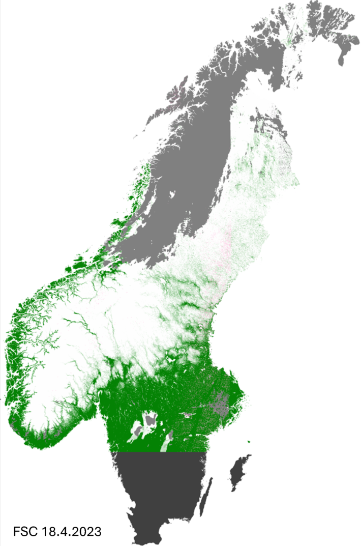
Fractional Snow Cover (FSC)
This is a product providing fractional snow cover (%). The product provides regular information on snow cover fraction (0-100 %) per grid cell for the given land area except for land ice areas and water bodies. The product is based on optical satellite data, in particular from medium-resolution sensors. Depending on the algorithm applied, the effect of canopy cover (forest) may be compensated for. Clouds are masked with the best available and applicable cloud-detection algorithm working over a snow-covered surface.
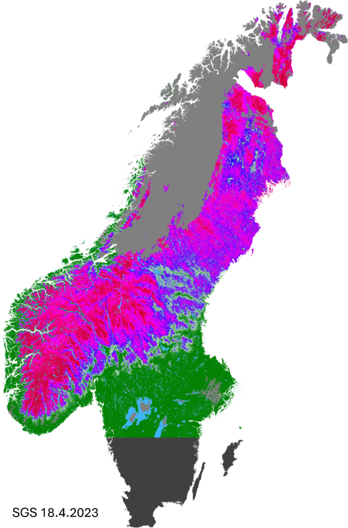
Snow Grain Size (SGS)
This is a product providing the average grain size of the snow cover (currently uncalibrated value). The SGS product provides regular information on qualitative snow grain size per grid cell for the given land area except for land ice areas and water bodies. The product is based on optical satellite data, in particular from medium-resolution sensors. The algorithm requires full snow cover (with no tall vegetation extending above the snow surface). Areas with less than full snow cover are usually filled in with FSC of coarse categories. Clouds are masked with the best available and applicable cloud-detection algorithm working over a snow-covered surface.
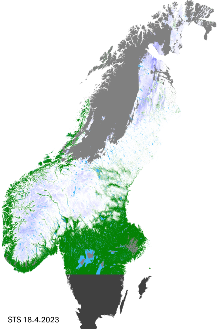
Surface Temperature Snow (STS)
This is a product providing the surface skin temperature of the snow (°C). The STS product provides regular information on snow surface skin temperature per grid cell for the given land area except for land ice areas and water bodies. The product is based on optical satellite data, in particular from medium-resolution sensors. The algorithm requires full snow cover (with no tall vegetation extending above the snow surface). Areas with less than full snow cover are usually filled in with FSC of coarse categories. Clouds are masked with the best available and applicable cloud-detection algorithm working over a snow-covered surface.
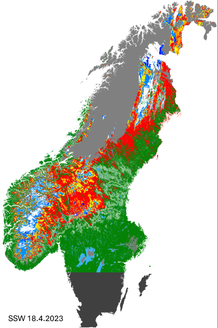
Snow Surface Wetness (SSW)
This is a product providing categories of liquid water content in the snow surface (categorial). The SSW product provides regular information on snow surface wetness categories (number of categories may vary) per grid cell for the given land area except for land ice areas and water bodies. The product is based on optical satellite data, in particular from medium-resolution sensors. The algorithm requires full snow cover (with no tall vegetation extending above the snow surface). Areas with less than full snow cover are usually filled in with FSC based on coarse categories. Clouds are masked with the best available and applicable cloud-detection algorithm working over a snow-covered surface.
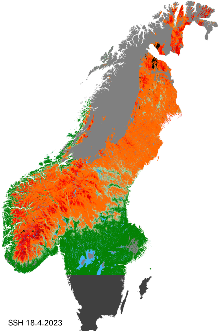
Snow Surface Hoar (SSH)
This is a product providing the average grain size of large snow crystals under cold conditions which are likely surface hoar (currently uncalibrated value). The SSH product provides regular information on snow surface per grid cell for the given land area except for land ice areas and water bodies. The product is based on optical satellite data, in particular from medium-resolution sensors. The algorithm requires full snow cover (with no tall vegetation extending over the snow surface). Areas with less than full snow cover are usually filled in with FSC of coarse categories. Clouds are masked with the best available and applicable cloud-detection algorithm working over a snow-covered surface.
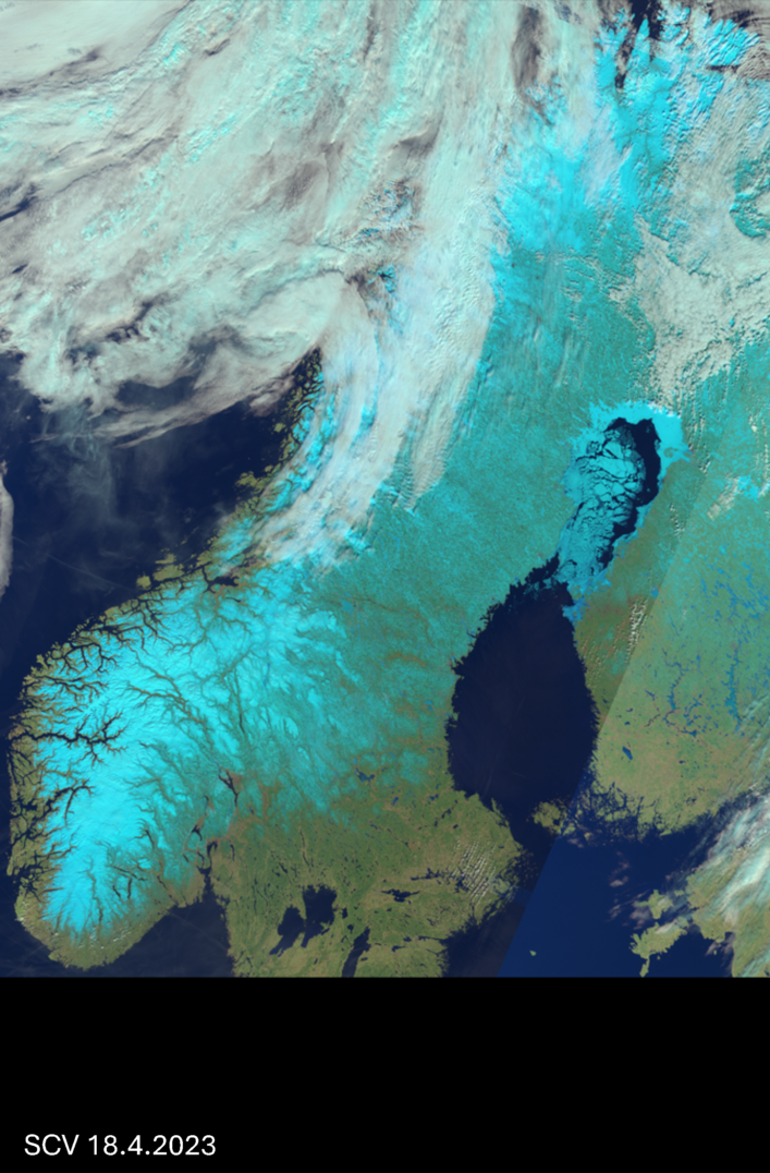
Snow Cover Visualisation (SCV)
This is a product enhancing the visual appearance of snow. Primarily intended for diagnostic purposes. The SCV product is only for visualisation of the snow cover by combining three bands into a colour composite image (“false colour”) that visually enhances the presence of snow. The product combines three bands which are typically around 1600, 850 and 550 nm and viewed as a red, green and blue composite.
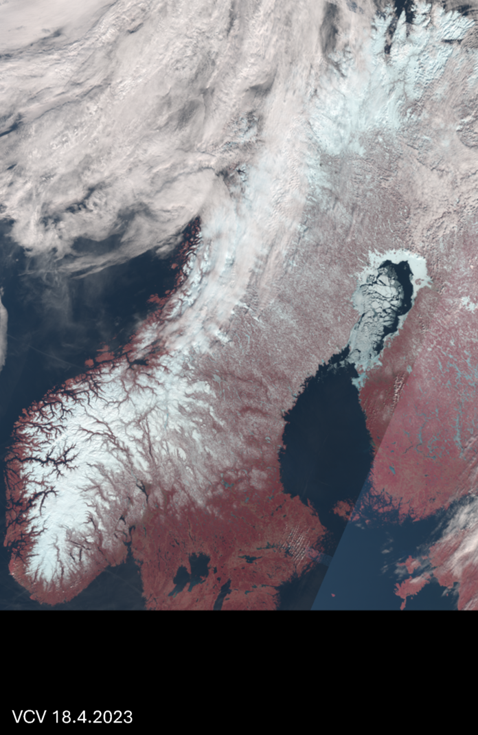
Vegetation Cover Visualisation (VCV)
This is a product enhancing the visual appearance of vegetation. Primarily intended for diagnostic purposes. The VCV product is only for visualisation of the vegetation cover by combining three bands into a colour composite image (“false colour”) that visually enhances the presence of vegetation. The product combines three bands which are typically around 850, 700 and 550 nm and viewed as a red, green and blue composite.
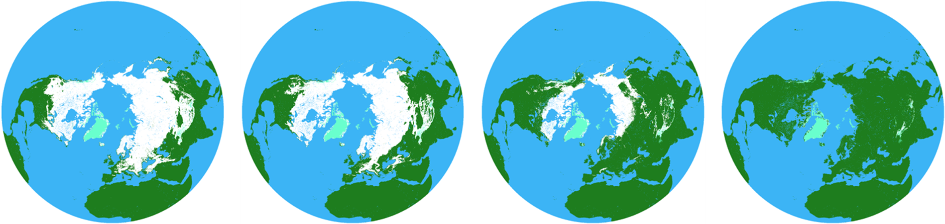
CryoClim Fractional Snow Cover (FSC)
This is a product providing fractional snow cover (%) on the global scale and as a long time series of daily observations. The FSC product provides regular information on snow cover fraction (0-100 %) per grid cell (5 × 5 km) for all land areas except for land ice and water bodies. The product gives daily full global coverage independent of clouds and polar-night darkness. The product is based on a sensor-fusion algorithm combining AVHRR GAC (optical), SMMR, SSM/I and SSMIS (passive microwave radiometer) data.